distribuciÓn de la infraestructura para la pequeÑa ... · utilizó el programa arcview para...
TRANSCRIPT
433
* Autor responsable v Author for correspondence.Recibido: agosto, 2013. Aprobado: septiembre, 2013.Publicado como ARTÍCULO en ASyD 10: 433-441. 2013.
DISTRIBUCIÓN DE LA INFRAESTRUCTURA PARA LA PEQUEÑA IRRIGACIÓN EN EL CAMPO POBLANO
DISTRIBUTION OF INFRASTRUCTURE FOR SMALL-SCALE IRRIGATION IN THE PUEBLA COUNTRYSIDE
María de Lourdes Hernández-Rodríguez1*, Juan J. Castellón Gómez2
1El Colegio de Tlaxcala, A.C. Melchor Ocampo No 28, San Pablo Apetatitlán, Tlax. Tel y fax 246 46 458 74 ([email protected]) 2Instituto Tecnológico del Altiplano de Tlaxcala Km.7.5 Carr. Fed. San Martín Texmelucan-Tlax, San Diego Xocoyucan, Tlax. Tel y fax 248 48 428 19 ([email protected])
Resumen
El agua es uno de los recursos naturales básicos para la producción de alimentos, por lo que es fundamental conocer la ubicación de sus fuentes de abastecimiento, distribución, superficie beneficiada y número de usuarios. El objetivo de este trabajo es contribuir a identificar la infraestructura hidroagrícola en el pequeño riego, el agua disponible y el potencial humano dedicado al riego en Puebla. La investigación se basó en información disponible so-bre agua, cultivos y usuarios agrícolas de la Comisión Nacional del Agua (CONAGUA), SAGARPA y El Colegio de Tlaxcala. Se utilizó el programa Arcview para definir las regiones naturales y la georreferenciación en coordenadas UTM de las fuentes de aprovechamiento. Se encontró que en Puebla, la “Pequeña Irri-gación” está constituida por sistemas abastecidos principalmente por pozos profundos, manantiales, derivadoras y plantas de bom-beo, lo que implica un total de 5120 obras atendidas por 51 074 agricultores en 81 818 ha irrigadas, con un volumen de agua de 911.6 Mm3. Esta infraestructura se encuentra en 56 % de los municipios poblanos, destacando a nivel regional los Valles de At-lixco-Izúcar, Puebla, Llanos de San Juan, Sierra, y Valles de Acat-lán y Huauchinango, donde el agua está destinada a la producción de hortalizas, ornamentales y forrajes a cielo abierto.
Palabras clave: abastecimiento de agua, infraestructura, región, usuarios.
IntRoduccIón
Para la agricultura, el riego es uno de los insu-mos más importantes para la producción de alimentos, por lo que conocer la ubicación
AbstRAct
Water is one of the basic natural resources for food production, which is why it is fundamental to understand the location its supply sources, its distribution, the surface benefited and the number of users. The objective of this study is to contribute to identify the hydro-agricultural infrastructure for small-scale irrigation, the water available and the human potential devoted to irrigation in Puebla. The research was based on information available about water, crops and agricultural users from the National Water Commission (Comisión Nacional del Agua, CONAGUA), SAGARPA and El Colegio de Tlaxcala. The Arcview software was used to define the natural regions and geo-reference in UTM coordinates of the supply sources. It was found that in Puebla, “Small-scale Irrigation” is constituted by systems supplied primarily by deep wells, springs, diverters and pumping plants, which implies a total of 5120 works manned by 51 074 farmers in 81 818 ha that are irrigated, with a water volume of 911.6 Mm3. This infrastructure is found in 56 % of the municipalities in Puebla, with the following standing out at the regional level: Valles de Atlixco-Izúcar, Puebla, Llanos de San Juan, Sierra, and Valles de Acatlán and Huauchinango, where the water is destined to the production of vegetables, ornamentals and fodders in the outdoors.
Key words: water supply, infrastructure, region, users.
IntRoductIon
For agriculture, irrigation is one of the most important inputs for food production, which is why knowing the location of its supply sources,
the surface to be served, and the number of users officially organized for its exploitation becomes an important element in agricultural planning for public
AGRICULTURA, SOCIEDAD Y DESARROLLO, OCTUBRE - DICIEMBRE 2013
VOLUMEN 10, NÚMERO 4434
de sus fuentes de abastecimiento, superficie atendi-ble y número de usuarios oficialmente organizados para su aprovechamiento, se convierte en un primer elemento de planificación agrícola para la adminis-tración pública, particularmente en regiones carac-terizadas por su alto potencial agrícola, como lo es el altiplano mexicano; en este sentido, y partiendo de la información disponible, este trabajo pretende ser un documento informativo que contribuya a la toma de decisiones de los responsables de la administración del agua y a la organización de agricultores con riego, a fin de identificar la ubicación de la infraestructura hidroagrícola y el potencial humano dedicado a este tipo de agricultura en el estado de Puebla. FAO (1996) y Graizbord, (2004) señalan que la agricultura es la actividad productiva más deman-dante e ineficiente en el aprovechamiento del recurso hídrico, ya que producir alimentos requiere un con-sumo de 2000 a 20 000 m3 ha-1 por ciclo agrícola, dependiendo de las preferencias en el consumo de la población, clima y eficiencia de los sistemas locales de producción. En México se estima que la agricultura de riego se practica en 6.5 millones ha, con 1.2 km3 de agua y 1.45 millones de agricultores; para 2010, esto per-mitió 27 % de la superficie nacional cosechada, con una producción total de 11 millones de toneladas de alimentos (CONAGUA-SEMARNAT, 2010; SIAP/SAGARPA, 2010). En tal sentido, el estado de Pue-bla3 reportó, para el mismo año, una disposición de 2008.7 hm3 de agua; sin embargo, el Registro Público de Derechos de Agua (REPDA) tiene registrados sólo 1201.4 hm3 destinados al agua para riego, los que se destinan a 149.5 mil ha en favor de 50 338 agriculto-res organizados (CONAGUA-SEMARNAT, 2010; SIAP-SAGARPA, 2010 y CONAGUA, 2011). Sin embargo, esta información no permite identificar el potencial hídrico del estado por regiones para identi-ficar el uso del agua por la pequeña irrigación y, con ello, destacar su viabilidad productiva, por lo que se plantearon las siguientes preguntas: ¿Cuál es la situa-ción de la pequeña irrigación en Puebla?, ¿En qué regiones se practica?, ¿Existen regiones con más riego que otras al interior del estado? Por ello, se planteó el siguiente objetivo: Analizar a la pequeña irrigación en el estado de Puebla con base en el tipo y la ubi-cación de sus fuentes de abastecimiento, superficie atendible, número de usuarios beneficiarios y región natural a la que pertenecen.
administration, particularly in regions characterized by their high agricultural potential, such as the Mexican high plateau; in that sense, and stemming from the information available, this study attempts to be an informative document that contributes to the decision-making of those responsible for managing water and to the organization of farmers with irrigation, in order to identify the location of hydro-agricultural infrastructure and the human potential devoted to this type of agriculture in the state of Puebla. FAO (1996) and Graizbord (2004) point out that agriculture is the most demanding and inefficient productive activity in terms of the use of the water resource, since producing food requires a consumption of 2000 to 20 000 m3 ha-1 per agricultural cycle, depending on the preferences in the consumption of the population, the climate and the efficiency of the local production systems. In México, it is estimated that agriculture with irrigation is practiced on 6.5 million ha, with 1.2 km3 of water and 1.45 millions of farmers; by 2010, this allowed 27 % of the national surface to be harvested, with a total production of 11 million tons of food (CONAGUA-SEMARNAT, 2010; SIAP/SAGARPA, 2010). In this sense, the state of Puebla3 reported, for that same year, an availability of 2008.7 hm3 of water; however, the Public Registry of Water Rights (Registro Público de Derechos de Agua, REPDA) only has 1201.4 hm3 registered as destined for irrigation water, which are allotted to 149.5 thousand ha in favor of 50 338 organized farmers (CONAGUA-SEMARNAT, 2010; SIAP-SAGARPA, 2010 y CONAGUA, 2011). However, this information does not allow identifying the water potential of the state by regions to identify the water use for small-scale irrigation and, with it, to highlight its productive viability. Therefore, the following questions were established: What is the situation of small-scale irrigation in Puebla? What regions is it practiced in? Are there regions with more irrigation than others, in the state? Thus, the following objective was set out: To analyze small-scale irrigation in the state of Puebla based on the type and location of its supply sources, the surface to be served, the number of beneficiary users, and the natural region to which they belong.
435AYALA-GARAY et al.
DISTRIBUCIÓN DE LA INFRAESTRUCTURA PARA LA PEQUEÑA IRRIGACIÓN EN EL CAMPO POBLANO
metodologíA
El estado de Puebla se encuentra ubicado en el altiplano mexicano entre las coordenadas geográficas 20°50’ y 17°52’ de latitud Norte, y 96°43’ y 99°04’ de longitud Oeste. Cuenta con una extensión de 34 306 km2 agrupados en 217 municipios los cuales, siguiendo la regionalización natural propuesta por Gutiérrez et al., (2010), se agruparon en 15 regiones naturales, como se muestra en el Cuadro 1. La investigación se basó en los datos sobre su-perficie irrigable, según CONAGUA-SEMARNAP (1998), así como en la información disponible so-bre volumen de agua concesionada disponible en las bases de datos del Registro Público de Derechos de Agua de CONAGUA-SEMARNAP (2010); de esta misma base, se utilizó la ubicación geográfica de las fuentes de aprovechamiento, las cuales se convirtie-ron a coordenadas UTM para su proyección carto-gráfica mediante el programa Arcview 9.3, los cuales se representaron en mapas temáticos, agrupándolos de acuerdo con el tipo de infraestructura hidrográfica utilizada.
lA InfRAestRuctuRA pARA lA pequeñA IRRIgAcIón
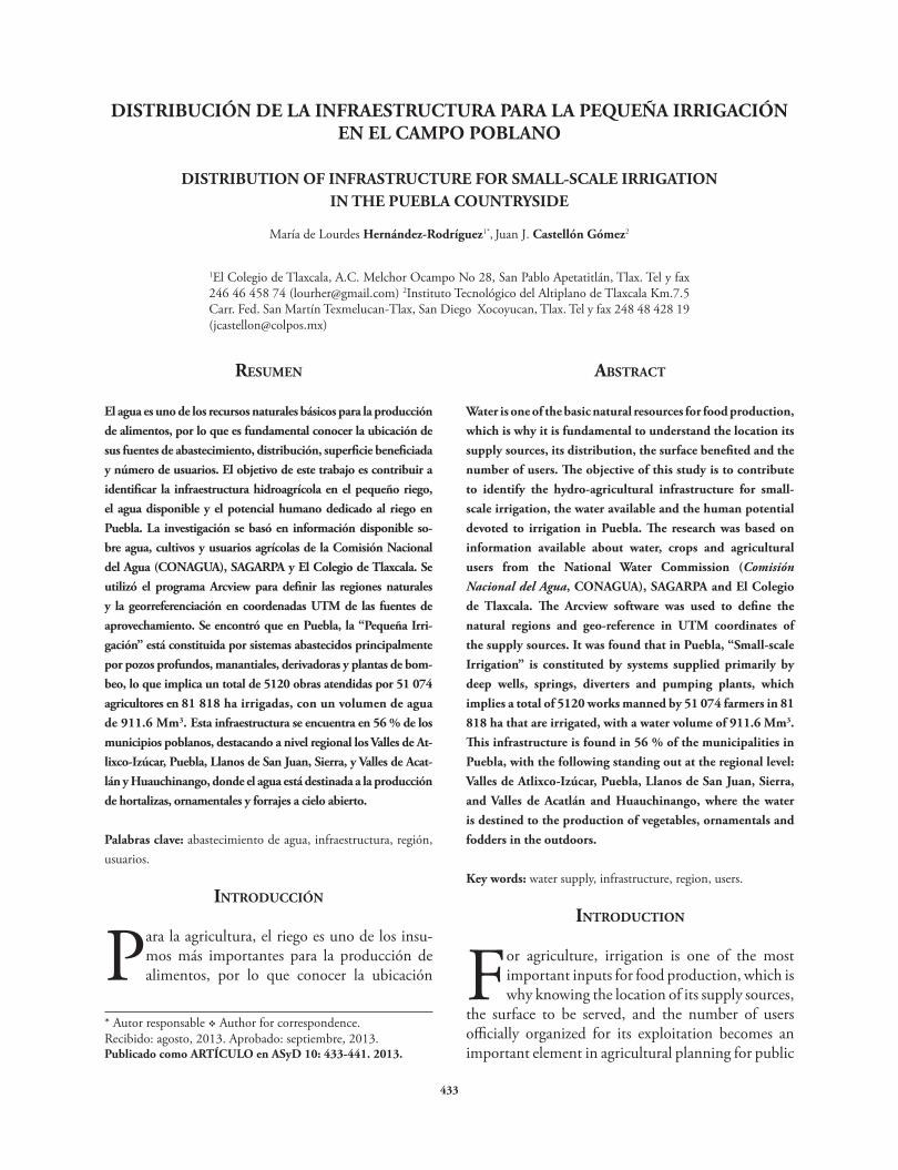
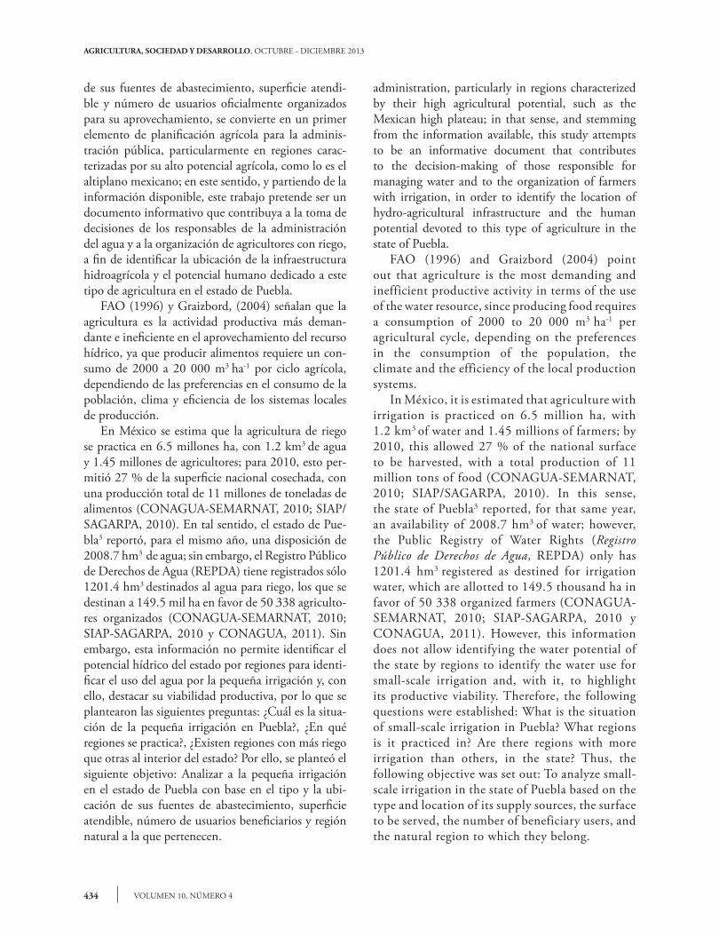
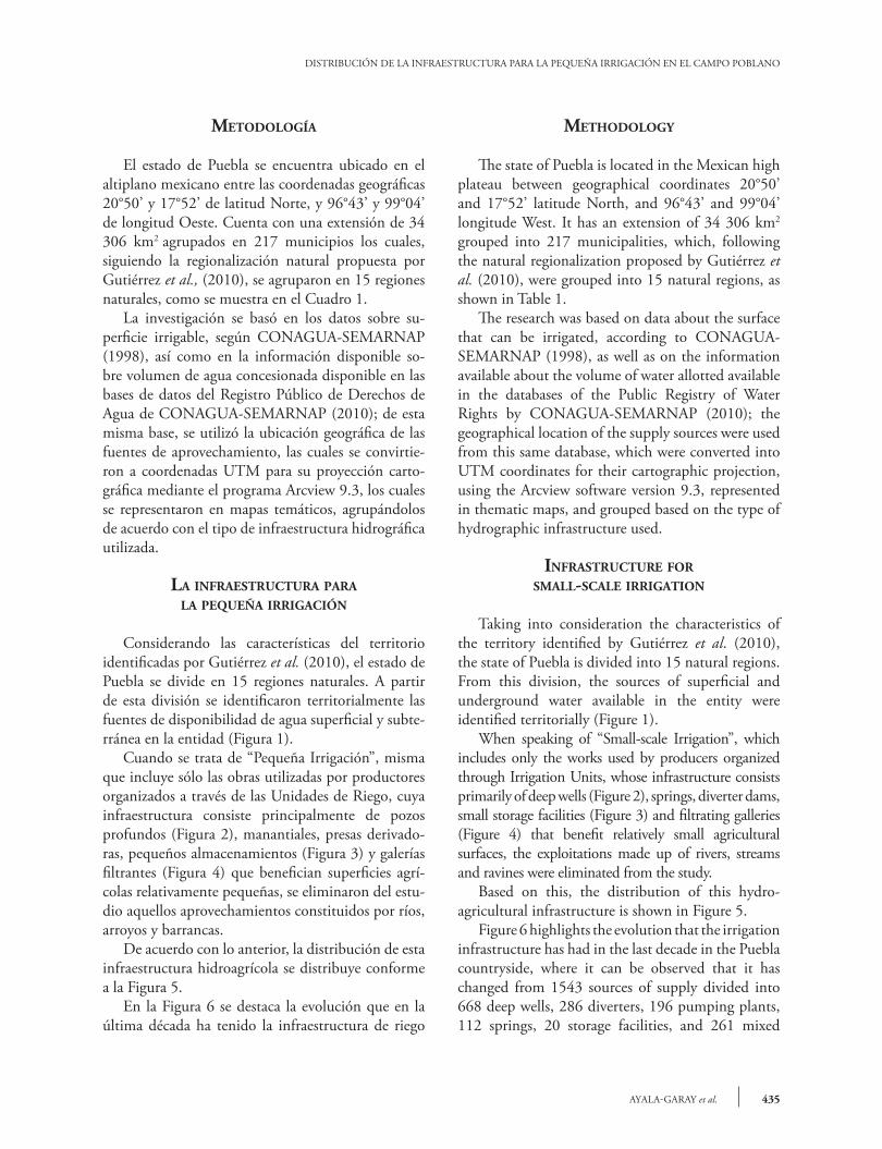
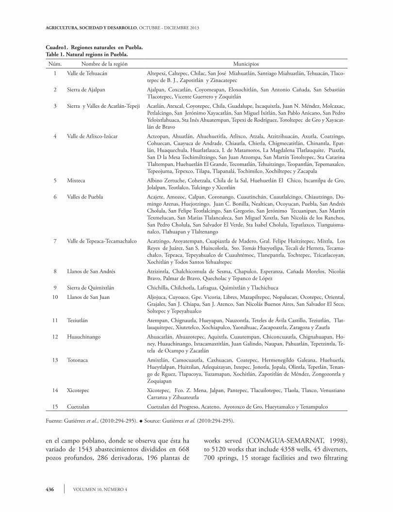
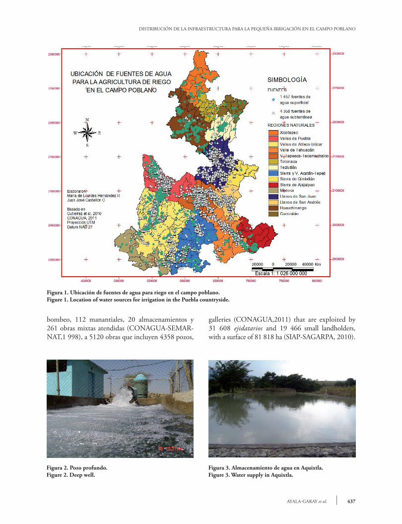
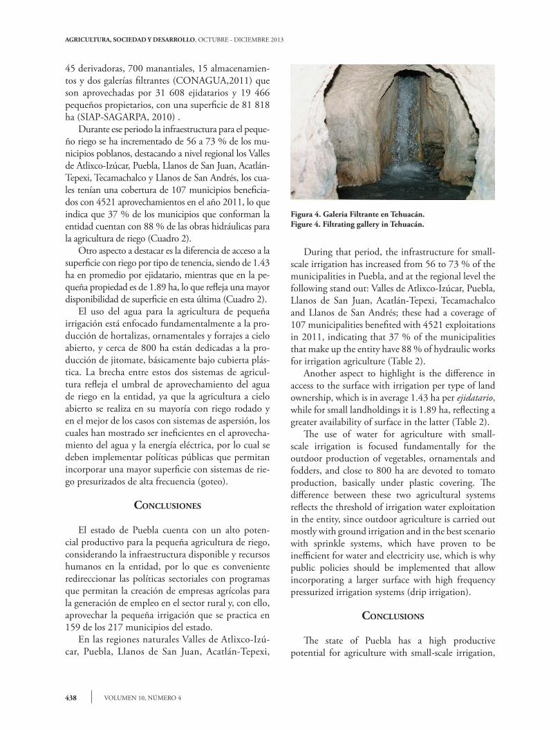
Considerando las características del territorio identificadas por Gutiérrez et al. (2010), el estado de Puebla se divide en 15 regiones naturales. A partir de esta división se identificaron territorialmente las fuentes de disponibilidad de agua superficial y subte-rránea en la entidad (Figura 1). Cuando se trata de “Pequeña Irrigación”, misma que incluye sólo las obras utilizadas por productores organizados a través de las Unidades de Riego, cuya infraestructura consiste principalmente de pozos profundos (Figura 2), manantiales, presas derivado-ras, pequeños almacenamientos (Figura 3) y galerías filtrantes (Figura 4) que benefician superficies agrí-colas relativamente pequeñas, se eliminaron del estu-dio aquellos aprovechamientos constituidos por ríos, arroyos y barrancas. De acuerdo con lo anterior, la distribución de esta infraestructura hidroagrícola se distribuye conforme a la Figura 5. En la Figura 6 se destaca la evolución que en la última década ha tenido la infraestructura de riego
methodology
The state of Puebla is located in the Mexican high plateau between geographical coordinates 20°50’ and 17°52’ latitude North, and 96°43’ and 99°04’ longitude West. It has an extension of 34 306 km2
grouped into 217 municipalities, which, following the natural regionalization proposed by Gutiérrez et al. (2010), were grouped into 15 natural regions, as shown in Table 1. The research was based on data about the surface that can be irrigated, according to CONAGUA-SEMARNAP (1998), as well as on the information available about the volume of water allotted available in the databases of the Public Registry of Water Rights by CONAGUA-SEMARNAP (2010); the geographical location of the supply sources were used from this same database, which were converted into UTM coordinates for their cartographic projection, using the Arcview software version 9.3, represented in thematic maps, and grouped based on the type of hydrographic infrastructure used.
InfRAstRuctuRe foR smAll-scAle IRRIgAtIon
Taking into consideration the characteristics of the territory identified by Gutiérrez et al. (2010), the state of Puebla is divided into 15 natural regions. From this division, the sources of superficial and underground water available in the entity were identified territorially (Figure 1). When speaking of “Small-scale Irrigation”, which includes only the works used by producers organized through Irrigation Units, whose infrastructure consists primarily of deep wells (Figure 2), springs, diverter dams, small storage facilities (Figure 3) and filtrating galleries (Figure 4) that benefit relatively small agricultural surfaces, the exploitations made up of rivers, streams and ravines were eliminated from the study. Based on this, the distribution of this hydro-agricultural infrastructure is shown in Figure 5. Figure 6 highlights the evolution that the irrigation infrastructure has had in the last decade in the Puebla countryside, where it can be observed that it has changed from 1543 sources of supply divided into 668 deep wells, 286 diverters, 196 pumping plants, 112 springs, 20 storage facilities, and 261 mixed
AGRICULTURA, SOCIEDAD Y DESARROLLO, OCTUBRE - DICIEMBRE 2013
VOLUMEN 10, NÚMERO 4436
en el campo poblano, donde se observa que ésta ha variado de 1543 abastecimientos divididos en 668 pozos profundos, 286 derivadoras, 196 plantas de
works served (CONAGUA-SEMARNAT, 1998), to 5120 works that include 4358 wells, 45 diverters, 700 springs, 15 storage facilities and two filtrating
Cuadro1. Regiones naturales en Puebla.Table 1. Natural regions in Puebla.
Núm. Nombre de la región Municipios
1 Valle de Tehuacán Altepexi, Caltepec, Chilac, San José Miahuatlán, Santiago Miahuatlán, Tehuacán, Tlaco-tepec de B. J., Zapotitlán y Zinacatepec
2 Sierra de Ajalpan Ajalpan, Coxcatlán, Coyomeapan, Eloxochitlán, San Antonio Cañada, San Sebastián Tlacotepec, Vicente Guerrero y Zoquitlán
3 Sierra y Valles de Acatlán-Tepeji Acatlán, Atexcal, Coyotepec, Chila, Guadalupe, Ixcaquixtla, Juan N. Méndez, Molcaxac, Petlalcingo, San Jerónimo Xayacatlán, San Miguel Ixitlán, San Pablo Anicano, San Pedro Yeloixtlahuaca, Sta Inés Ahuatempan, Tepexi de Rodríguez, Totoltepec de Gro y Xayacat-lán de Bravo
4 Valle de Atlixco-Izúcar Acteopan, Ahuatlán, Ahuehuetitla, Atlixco, Atzala, Atzitzihuacán, Axutla, Coatzingo, Cohuecan, Cuayuca de Andrade, Chiautla, Chietla, Chigmecatitlán, Chinantla, Epat-lán, Huaquechula, Huatlatlauca, I. de Matamoros, La Magdalena Tlatlauquite, Piaxtla, San D la Mesa Tochimiltzingo, San Juan Atzompa, San Martín Totoltepec, Sta Catarina Tlaltempan, Huehuetlán El Grande, Tecomatlán, Tehuitzingo, Teopantlán, Tepemaxalco, Tepeojuma, Tepexco, Tilapa, Tlapanalá, Tochimilco, Xochiltepec y Zacapala
5 Mixteca Albino Zertuche, Cohetzala, Chila de la Sal, Huehuetlán El Chico, Ixcamilpa de Gro, Jolalpan, Teotlalco, Tulcingo y Xicotlán
6 Valles de Puebla Acajete, Amozoc, Calpan, Coronango, Cuautinchán, Cuautlalcingo, Chiautzingo, Do-mingo Arenas, Huejotzingo, Juan C. Bonilla, Nealtican, Ocoyucan, Puebla, San Andrés Cholula, San Felipe Teotlalcingo, San Gregorio, San Jerónimo Tecuanipan, San Martín Texmelucan, San Matías Tlalancaleca, San Miguel Xoxtla, San Nicolás de los Ranchos, San Pedro Cholula, San Salvador El Verde, Sta Isabel Cholula, Tepatlaxco, Tianguisma-nalco, Tlahuapan y Tlaltenango
7 Valle de Tepeaca-Tecamachalco Acatzingo, Atoyatempan, Cuapiaxtla de Madero, Gral. Felipe Huitzitepec, Mixtla, Los Reyes de Juárez, San S. Huixcolotla, Sto. Tomás Hueyotlipa, Tecali de Herrera, Tecama-chalco, Tepeaca, Tepeyahualco de Cuauhtémoc, Tlanepantla, Tochtepec, Tzicatlacoyan, Xochitlán y Todos Santos Yehualtepec
8 Llanos de San Andrés Atzizintla, Chalchicomula de Sesma, Chapulco, Esperanza, Cañada Morelos, Nicolás Bravo, Palmar de Bravo, Quecholac y Tepanco de López
9 Sierra de Quimixtlán Chichilla, Chilchotla, Lafragua, Quimixtlán y Tlachichuca
10 Llanos de San Juan Aljojuca, Cuyoaco, Gpe. Vicoria, Libres, Mazapiltepec, Nopalucan, Ocotepec, Oriental, Grajales, San J. Chiapa, San J. Atenco, San Nicolás Buenos Aires, San Salvador El Seco, Soltepec y Tepeyahualco
11 Teziutlán Atempan, Chignautla, Hueyapan, Nauzontla, Teteles de Ávila Castillo, Teziutlán, Tlat-lauquitepec, Xiutetelco, Xochiapulco, Yaonáhuac, Zacapoaxtla, Zaragoza y Zautla
12 Huauchinango Ahuacatlán, Ahuazotepec, Aquixtla, Cuautempan, Chiconcuautla, Chignahuapan, Ho-ney, Huauchinango, Ixtacamaxtitlán, Juan Galindo, Naupan, Pahuatlán, Tepetzintla, Te-tela de Ocampo y Zacatlán
13 Totonaca Amixtlán, Camocuautla, Caxhuacan, Coatepec, Hermenegildo Galeana, Huehuetla, Hueytlalpan, Huitzilan, Atlequizayan, Ixtepec, Jonotla, Jopala, Olintla, Tepetlán, Tenan-go de Rguez, Tlapacoya, Tuzamapan, Xochitlán, Zapotitlán de Méndez, Zongozontla y Zoquiapan
14 Xicotepec Xicotepec, Fco. Z. Mena, Jalpan, Pantepec, Tlacuilotepec, Tlaola, Tlaxco, Venustiano Carranza y Zihuateutla
15 Cuetzalan Cuetzalan del Progreso, Acateno, Ayotoxco de Gro, Hueytamalco y Tenampulco
Fuente: Gutiérrez et al., (2010:294-295). u Source: Gutiérrez et al. (2010:294-295).
437AYALA-GARAY et al.
DISTRIBUCIÓN DE LA INFRAESTRUCTURA PARA LA PEQUEÑA IRRIGACIÓN EN EL CAMPO POBLANO
bombeo, 112 manantiales, 20 almacenamientos y 261 obras mixtas atendidas (CONAGUA-SEMAR-NAT,1 998), a 5120 obras que incluyen 4358 pozos,
galleries (CONAGUA,2011) that are exploited by 31 608 ejidatarios and 19 466 small landholders, with a surface of 81 818 ha (SIAP-SAGARPA, 2010).
Figura 1. Ubicación de fuentes de agua para riego en el campo poblano.Figure 1. Location of water sources for irrigation in the Puebla countryside.
Figura 2. Pozo profundo.Figure 2. Deep well.
Figura 3. Almacenamiento de agua en Aquixtla.Figure 3. Water supply in Aquixtla.
AGRICULTURA, SOCIEDAD Y DESARROLLO, OCTUBRE - DICIEMBRE 2013
VOLUMEN 10, NÚMERO 4438
45 derivadoras, 700 manantiales, 15 almacenamien-tos y dos galerías filtrantes (CONAGUA,2011) que son aprovechadas por 31 608 ejidatarios y 19 466 pequeños propietarios, con una superficie de 81 818 ha (SIAP-SAGARPA, 2010) . Durante ese periodo la infraestructura para el peque-ño riego se ha incrementado de 56 a 73 % de los mu-nicipios poblanos, destacando a nivel regional los Valles de Atlixco-Izúcar, Puebla, Llanos de San Juan, Acatlán-Tepexi, Tecamachalco y Llanos de San Andrés, los cua-les tenían una cobertura de 107 municipios beneficia-dos con 4521 aprovechamientos en el año 2011, lo que indica que 37 % de los municipios que conforman la entidad cuentan con 88 % de las obras hidráulicas para la agricultura de riego (Cuadro 2). Otro aspecto a destacar es la diferencia de acceso a la superficie con riego por tipo de tenencia, siendo de 1.43 ha en promedio por ejidatario, mientras que en la pe-queña propiedad es de 1.89 ha, lo que refleja una mayor disponibilidad de superficie en esta última (Cuadro 2). El uso del agua para la agricultura de pequeña irrigación está enfocado fundamentalmente a la pro-ducción de hortalizas, ornamentales y forrajes a cielo abierto, y cerca de 800 ha están dedicadas a la pro-ducción de jitomate, básicamente bajo cubierta plás-tica. La brecha entre estos dos sistemas de agricul-tura refleja el umbral de aprovechamiento del agua de riego en la entidad, ya que la agricultura a cielo abierto se realiza en su mayoría con riego rodado y en el mejor de los casos con sistemas de aspersión, los cuales han mostrado ser ineficientes en el aprovecha-miento del agua y la energía eléctrica, por lo cual se deben implementar políticas públicas que permitan incorporar una mayor superficie con sistemas de rie-go presurizados de alta frecuencia (goteo).
conclusIones
El estado de Puebla cuenta con un alto poten-cial productivo para la pequeña agricultura de riego, considerando la infraestructura disponible y recursos humanos en la entidad, por lo que es conveniente redireccionar las políticas sectoriales con programas que permitan la creación de empresas agrícolas para la generación de empleo en el sector rural y, con ello, aprovechar la pequeña irrigación que se practica en 159 de los 217 municipios del estado. En las regiones naturales Valles de Atlixco-Izú-car, Puebla, Llanos de San Juan, Acatlán-Tepexi,
During that period, the infrastructure for small-scale irrigation has increased from 56 to 73 % of the municipalities in Puebla, and at the regional level the following stand out: Valles de Atlixco-Izúcar, Puebla, Llanos de San Juan, Acatlán-Tepexi, Tecamachalco and Llanos de San Andrés; these had a coverage of 107 municipalities benefited with 4521 exploitations in 2011, indicating that 37 % of the municipalities that make up the entity have 88 % of hydraulic works for irrigation agriculture (Table 2). Another aspect to highlight is the difference in access to the surface with irrigation per type of land ownership, which is in average 1.43 ha per ejidatario, while for small landholdings it is 1.89 ha, reflecting a greater availability of surface in the latter (Table 2). The use of water for agriculture with small-scale irrigation is focused fundamentally for the outdoor production of vegetables, ornamentals and fodders, and close to 800 ha are devoted to tomato production, basically under plastic covering. The difference between these two agricultural systems reflects the threshold of irrigation water exploitation in the entity, since outdoor agriculture is carried out mostly with ground irrigation and in the best scenario with sprinkle systems, which have proven to be inefficient for water and electricity use, which is why public policies should be implemented that allow incorporating a larger surface with high frequency pressurized irrigation systems (drip irrigation).
conclusIons
The state of Puebla has a high productive potential for agriculture with small-scale irrigation,
Figura 4. Galeria Filtrante en Tehuacán.Figure 4. Filtrating gallery in Tehuacán.

439AYALA-GARAY et al.
DISTRIBUCIÓN DE LA INFRAESTRUCTURA PARA LA PEQUEÑA IRRIGACIÓN EN EL CAMPO POBLANO
Tepeaca-Tecamachalco y Llanos de San Andrés. Va-lles de Atlixco-Izúcar, Tepeaca-Tecamachalco, Llanos de San Andrés, Valle de Tehuacán y Llanos de San Juan, se encuentra 88 % de la infraestructura para la pequeña irrigación. Los pozos profundos y manan-tiales abastecen más de 80 % de la superficie regable; en cuanto al número de obras, los pozos y los manan-tiales se destacan por sumar 98 % de ellas, mientras que los pozos y presas derivadoras que hay en el es-tado cuentan con 88 % del agua concesionada en la agricultura de riego.
notAs
3Puebla cuenta con 2469 hm3 de agua, 81.3 % se destina a la agricultura, 15.5 % al abastecimiento
taking into consideration the infrastructure and human resources available in the entity, which is why it is convenient to redirect the sectorial policies with programs that allow creating agricultural enterprises to generate employment in the rural sector and, with this, to take advantage of small-scale irrigation that is used in 159 of the 217 municipalities of the state. In the natural regions of Valles de Atlixco-Izúcar, Puebla, Llanos de San Juan, Acatlán-Tepexi, Tepeaca-Tecamachalco, Llanos de San Andrés, and Valle de Tehuacán, there is 88 % of the infrastructure for small-scale irrigation. The deep wells and springs supply more than 80 % of the surface that can be irrigated; in terms of the number of works, the wells and the springs stand out since they represent 98 % of them, while the wells and diverter dams in the
Figura 5. Concesiones e infraestructura para la pequeña irrigación en Puebla.Figure 5. Concessions and infrastructure for small-scale irrigation in Puebla.

AGRICULTURA, SOCIEDAD Y DESARROLLO, OCTUBRE - DICIEMBRE 2013
VOLUMEN 10, NÚMERO 4440
público, 2.9 % a la industria autoabastecida y 0.3 % a la termoeléctrica (CONAGUA-SEMARNAT, 2010). u Puebla has 2469 hm3 of water; 81.3 % is destined to agriculture, 15.5 % to public supply, 2.9 % to self-supplied industry and 0.3 % to thermoelectric plants (CONAGUA-SEMARNAT, 2010).
Agradecimientos
Se reconoce el trabajo de León Felipe Castellón Her-nández y Alexis Lara Azamar, estudiantes del ITESM Campus Puebla, en la conversión de la proyección cartográfica de las fuentes de abastecimiento, insu-mo indispensable para la elaboración de los mapas temáticos.
lIteRAtuRA cItAdA
CONAGUA-SEMARNAP. 1998. Unidades de Riego Organiza-das: Puebla CONAGUA-Coordinación de Uso Eficiente del Agua y la Energía Eléctrica, SEMARNAT, COLPOS, Mon-tecillos, Estado de México.
CONAGUA-SEMARNAT. 2010. Estadísticas del agua en Méxi-co 2010:10 años de presentar agua en cifras. CONAGUA-SEMARNAT. México, D.F
CONAGUA. 2011. Base de datos REPDA http://www.cona-gua.gob.mx/Repda.aspx?Id=427f4195-50f4-4ec9-86a3-82c473105d7c (enero-marzo 2011)
state have 88 % of the water allotted to irrigation agriculture.
Acknowledgments
We recognize the work done by León Felipe Castellón Hernández and Alexis Lara Azamar, students from ITESM Campus Puebla, in converting the cartographic projection of the sources of supply, an essential input for the making of thematic maps.
- En of the English version -
Figura 6. Evolución de los aprovechamientos de agua para pequeña irrigación en Puebla.Figure 6. Evolution of water exploitation for small-scale irrigation in Puebla.
FAO. 1996. Producción de alimentos, función decisiva del agua. Disponible en http://www.fao.org/docrep/003/w2612s/w2612s7a.htm (25 marzo 2007).
Graizbord, B. 2004. Los umbrales del agua: preguntas y desa-fíos en… El futuro del agua en México. Graizbord, B., y J. Arroyo (coord). Universidad de Guadalajara, El Colegio de México, UCLA Programo of México, Profmex, Casa Juan Pablos. México, D.F.
Gutiérrez H. Lucino, Cuervo M. Mauro J., y Enrique O. Ortiz M. 2010. Regiones naturales y de planeación para el estado de Puebla. Análisis Económico. Disponible en: http://www.analisiseconomico.com.mx/pdf/3713.pdf (20 diciembre 2011)
SIAP-SAGARPA. 2010. Base de datos SIACON estado de Pue-bla-2009, cultivos cíclicos y perennes modalidad riego. Dispo-nible en: http://www.siap.sagarpa.gob.mx/index (5 enero 2011)
Pozos profundos43 %
Almacenamientos1 %
Derivadoras19 %
Manantiales 7 %
Plantas de bombeo
13 %
Almacenamiento0 %
Mixtos17 %
Derivaciones1 %
Galerias Filtranes0 %
Pozos profundos85 %
Manan-
tiales
14 %
1998 2011

441AYALA-GARAY et al.
DISTRIBUCIÓN DE LA INFRAESTRUCTURA PARA LA PEQUEÑA IRRIGACIÓN EN EL CAMPO POBLANO
Cua
dro
2. In
frae
stru
ctur
a pa
ra la
peq
ueña
irri
gaci
ón p
or re
gión
hid
roag
ríco
la.
Tabl
e 2.
Infr
astr
uctu
re fo
r sm
all-
scal
e ir
riga
tion
by
hydr
o-ag
ricu
ltur
al re
gion
.
Núm
.R
egió
nTo
tal
Con
in
frae
stru
ctur
aSu
perfi
cie
rega
ble
tota
l(h
a)
Núm
ero
de
apro
vech
a-m
ient
os
Vol
umen
de
agua
201
1(h
m3 /
año)
Supe
rfici
e co
n pe
queñ
o ri
ego
1998
(ha)
Núm
ero
de u
suar
ios
1998
1998
2011
1998
2011
Con
ceci
o-na
daE
xtra
ída
Ejid
oPP
Tota
lE
jido
PPTo
tal
1V
alle
de
Tehu
acán
97
917
338
.50
828
010
7.00
107.
4227
432
306
180
1819
8
2Si
erra
de
Aja
lpan
82
535
63.0
025
5911
.00
11.0
017
0631
220
1810
8114
012
21
3Si
erra
y V
alle
s de
A
catlá
n-Te
peji
1712
1544
14.7
016
269
224
.40
24.3
613
9520
2534
2016
5715
8632
73
4V
alle
de
Atli
xco-
Izúc
ar36
2325
38 7
03.3
050
511
0139
3.00
393.
7919
298
9849
29 1
4798
0250
8514
815
5M
ixte
ca9
57
696.
4020
240.
770.
7790
314
952
395
497
489
986
6V
alle
s de
Pue
bla
2824
2612
939
.50
253
793
88.8
089
.15
10 6
5362
1416
878
12 8
5971
5719
372
7V
alle
s de
Tep
eaca
-Te
cam
acha
lco
1816
1731
708
.70
139
596
93.1
093
.42
3778
2811
6589
2557
1592
4149
8Ll
anos
de
San
And
rés
94
917
781
.50
5755
448
.80
48.7
715
2611
8827
1476
545
312
18
9Si
erra
de
Qui
mix
tlán
50
232
2.80
173.
133.
13
10Ll
anos
de
San
Juan
1512
1515
902
.90
191
785
121.
0012
1.43
2882
6137
9019
1125
318
1443
11Te
ziut
lán
135
812
3.50
1535
2.70
2.70
3359
963
249
379
428
12H
uauc
hina
ngo
157
959
67.3
015
813
514
.60
14.5
723
1150
4072
6110
0121
9531
46
13To
tona
ca21
05
0.60
310.
940.
94
14X
icot
epec
95
52.
1010
160.
190.
2035
010
8914
3935
5489
15C
uetz
alan
50
21.
702
0.04
0.04
To
tal
217
122
159
149
466.
5015
4351
2091
0.00
911.
6845
109
36 7
9181
818
31 6
0819
466
51 0
74
Fuen
te: C
ON
AGU
A, 2
011;
SIA
P-SA
GAR
PA, 2
010
y C
ON
AGU
A-SE
MAR
NAP
, 199
8. u
Sou
rce:
CO
NAG
UA,
201
1; S
IAP-
SAG
ARPA
, 201
0 an
d C
ON
AGU
A-SE
MAR
NAP
, 199
8.